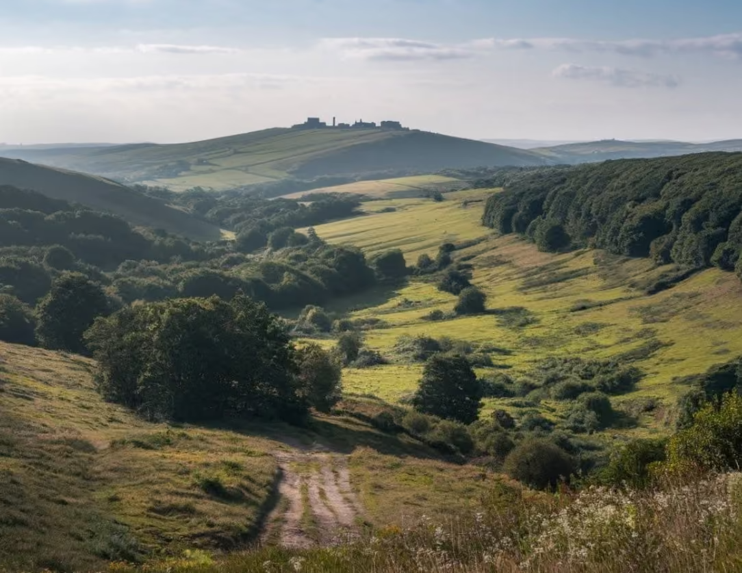
A grassy track winding down into a wooded valley in the North York Moors, with moorland hills beyond

Walks

Walks in the North York Moors

By Jon Cosson · Updated 18 October 2026

From twenty-minute riverside strolls to full days on the heather, some of the best walks in Yorkshire, all in one national park. Thirteen walks across the moors and coast, each compiled from Ordnance Survey mapping and the published sources listed on its page.

What walking in the Yorkshire Moors is actually like

The moors are high, open and exposed, but rarely steep for long. Most classic routes climb out of a wooded dale, run along a level moorland edge with enormous views, then drop back down. Paths are generally well trodden and waymarked, but the moor tops have few landmarks, so carry OS Explorer OL26 or OL27 and don't rely on phone signal.

Ground conditions matter more than distance here. After heavy rain the peat and bracken sections hold water, and the flagged causeways can be slippery. Boots, a windproof layer and more water than you think you need cover almost every day out. If you use a wheelchair, a mobility scooter or a pushchair, our guide to accessible days out explains the National Park's Miles without Stiles gradings and the easiest routes.

Nesting season on the moors runs roughly March to July, keep dogs on leads across open moorland, and check for grouse shooting notices in late summer and autumn.

Sleep near the trailheads

Self-catering cottages, village inns and farmhouse boltholes right across the moors, from the southern villages to the coast.

Browse places to stay

Which walk is right for you

For an easy start, the Thornton-le-Dale village loop is about a mile, while the Farndale daffodil walk is about three miles there and back. Whitby to Sandsend is graded easy too, but its six-mile return needs more time and the beach line depends on the tide. The Bridestones is easy to moderate over about three miles, with a steady climb and uneven ground beyond the car park.

The moderate routes are Mallyan Spout, about three miles on rocky, slippery riverside paths; the Hole of Horcum, five miles or seven with Skelton Tower; Roseberry Topping, from a short stepped climb to five- or six-mile circulars; and Sutton Bank to the White Horse, with short and circular variants. Lake Gormire adds a steep descent and climb over roughly eight miles. Whitby to Robin Hood's Bay is seven miles one way along the cliffs, while Esk Valley to Grosmont is about eight miles beside the river. These last three have terrain notes rather than a recorded difficulty grade.

Walks with a pub at the end

Thornton-le-Dale has pubs and cafés in the village centre. Farndale reaches Daffy Caffy at High Mill and the pub at Church Houses, while the Mallyan Spout circular passes the Birch Hall Inn at Beck Hole. Sutton Bank and Lake Gormire start beside the National Park Centre tearoom. Sandsend offers tea at the turning point, and the Bridestones has refreshments at the Dalby Forest hubs. Roseberry Topping's refreshments are in Great Ayton and Newton, not on the hill itself. Check opening before building a day around a stop.

Walks with dogs

The notes call for leads around livestock at Roseberry Topping, Thornton-le-Dale and Farndale, and close control at the Bridestones. Hole of Horcum crosses grazed moorland with ground-nesting birds. Mallyan Spout's wet rocks can be hard for small or elderly dogs. Check seasonal beach restrictions on Whitby to Sandsend, and keep dogs close on the cliff sections towards Robin Hood's Bay. The Esk Valley offers shade and water; its railway return accepts dogs, with limited space. Sutton Bank and Gormire have unfenced edges. The Coast to Coast has no recorded dogs note here.

Easy and accessible walks

The short Thornton-le-Dale pond loop is described as wheelchair friendly and close to flat. Farndale's largely surfaced daffodil path is graded Miles Without Stiles, For some, suitable for strong or assisted wheelchair users; the field-path return is not the accessible route. Sutton Bank has a short accessible viewpoint path, distinct from the full White Horse circuit. Published ascent figures do not cover every variant, so distance alone is not an access assessment.

The long-distance paths

The Cleveland Way runs 109 miles from Helmsley to Filey Brigg, usually over nine days, and is moderate to strenuous. Keep dogs on leads across its moorland. The Coast to Coast is 190 miles in all, with roughly fifty in the North York Moors. Its moors stages take four or five days, passing the Lion Inn, Falling Foss tea garden and the Bay Hotel at the finish.
Walk guides

Distance, time, difficulty, parking and whether dogs are welcome, shown up front. Shortest walks first. Use the filters to narrow the list, or tell us what you want and we will suggest a walk.

Showing 13 of 13 walks.

Roseberry Topping walk

Yorkshire's Matterhorn: the quick summit climb, or a circular taking in Captain Cook's Monument.

8°CMainly clearnearest reading, Danby

Distance
1 mile / 1.6 km, out-and-back

From about 1 mile there-and-back (direct climb) to a 5-mile circular, or around 6 miles taking in Captain Cook's Monument

Time
45 minutes for the quick climb; 2 to 3 hours for a circular
Ascent
Around 200 m (676 ft) on a 2.2-mile loop from Newton-under-Roseberry, per yorkshiremoors.co.uk. Published figures for the longer circular taking in Captain Cook's Monument disagree, from about 364 m (1,200 ft) to about 515 m (1,700 ft)
Difficulty
Moderate
Parking
Newton-under-Roseberry National Park car park; £3.90 up to 2 hours, £6.20 over 2 hours, coach £7.50; National Trust members pay
Dogs
Welcome, on a lead around livestock.

Walks from Thornton-le-Dale

A gentle beck-side village loop, and the climb from the village edge into the Dalby Forest trail network.

7°CPartly cloudynearest reading, Pickering

Distance
1 mile / 1.6 km, circular

About a mile around the village; 5 miles or more once you climb into Dalby Forest

Time
From 30 minutes to a full day, depending on how far into the forest you go
Ascent
No published figure for the village loop, which is close to flat. A Ramblers group log gives around 180 m (591 ft) for a 9.5-mile route out into Dalby Forest
Difficulty
Easy
Parking
Thornton le Dale (Maltongate) National Park car park; Up to 1 hour £3.10; 1 to 2 hours £3.90; over 2 hours £6.20; coaches £7.50 (National Park tariff); Summer weekends fill early
Dogs
Welcome, with leads through the village and across grazed fields.

The Bridestones walk

Weathered sandstone outcrops above Dalby Forest, on a National Trust nature reserve, circular from Staindale.

7°CMainly clearnearest reading, Dalby Forest

Distance
1.5 miles / 2.4 km, circular

Forestry England's waymarked Bridestones Trail, starting at Bridestones car park near Staindale Lake; not a longer moorland circuit

Ascent
No published ascent figure. Forestry England lists the trail by distance only
Difficulty
Moderate
Parking
Bridestones car park near Staindale Lake, Dalby Forest (Forestry England); A Forestry England hourly parking charge applies, National Trust members included. Forestry England tariff: up to 1 hour £3.50, 2 hours £6.50, 3 hours £9.50, 4 hours £12.50, over 4 hours £15; no charge if arriving without a car
Dogs
Welcome under close control. The reserve is grazed and there are ground-nesting birds from March to July, so a lead is the safe choice.

Sutton Bank to the White Horse of Kilburn

The upper out-and-back escarpment path towards the White Horse from Sutton Bank National Park Centre

8°COvercastnearest reading, Helmsley

Distance
1.75 miles / 2.8 km, out-and-back

Visit North Yorkshire lists this length for the upper out-and-back route; it is not a three-mile circuit

Time
About 1.5 hours, per Visit North Yorkshire
Ascent
No total ascent published; the route listing gives gradients no steeper than 1 in 12
Difficulty
Easy
Parking
Sutton Bank National Park Centre car park; £3.90 up to 2 hours, £6.20 over 2 hours, coach £7.50; admission to the centre itself is free
Dogs
Our Sutton Bank notes say only that the cliff edge is unfenced in places, so keep children and dogs close.

Mallyan Spout walk

Goathland's waterfall in a wooded gorge, the tallest in the North York Moors, short, scrambly and often wet underfoot.

8°CMainly clearnearest reading, Danby

Distance
3 miles / 4.8 km, circular

About 3 miles / 5 km circular from Goathland

Time
Around 1.5 to 2 hours
Ascent
About 450 feet (136 m) on the 3-mile circular from Goathland, per Walking Britain
Difficulty
Moderate
Parking
Goathland National Park car park, Beck Hole Road; £4.65 single rate; Limited on busy days, so arrive early
Dogs
Welcome on a lead. The rocky, slippery section close to the falls is hard going for small or elderly dogs.

Farndale daffodil walk

Sheets of wild daffodils along the River Dove each spring, a 6 km accessible there-and-back route from Low Mill.

8°COvercastnearest reading, Blakey Ridge

Distance
3.7 miles / 6.0 km, out-and-back

The National Park accessible there-and-back route, about 3 miles as the crow flies, not the optional field-path circuit

Time
1.5 to 2 hours at a gentle pace, longer with photograph stops
Ascent
33 m ascent, 36 m descent, in the National Park route data
Difficulty
Easy
Parking
Low Mill National Park car park; A current parking tariff was not confirmed; follow the signs at Low Mill; Fills early on fine spring weekends
Dogs
Welcome on a lead. The route crosses working farmland with sheep and lambs in early spring.

Hole of Horcum walk

The classic five-mile circular from Saltergate round the rim, over Levisham Moor, down Dundale Griff and back through the bottom of the Hole, with the Skelton Tower diversion for a longer day.

7°CMainly clearnearest reading, Hole of Horcum

Distance
5.2 miles / 8.4 km, circular

8.3 km (5.2 miles) on the National Park's published route; 11 km (7 miles) with the Skelton Tower diversion. Walking Britain measures the same loop at 8.5 km

Time
2 hours 15 minutes to 3 hours; about 4 hours with the Skelton Tower diversion (National Park)
Ascent
162 m (531 ft) of climb on the 8.3 km loop, by the National Park's published route; Walking Britain gives 227 m (750 ft). Highest point 281 m, lowest 119 m
Difficulty
Moderate
Parking
Hole of Horcum (Saltergate) car park, North York Moors National Park Authority; £3.90 up to 2 hours, £6.20 over 2 hours; coaches £7.50. Card at the machine or PayByPhone, no cash; the app needs a signal, so pay at the machine (National Park tariff, September 2026); Fills by late morning on fine weekends and through the heather season
Dogs
Welcome on a lead. Sheep and sometimes Highland cattle graze the moor and the Hole, and the Park asks for a short lead, under two metres, from 1 March to 31 July for the ground-nesting birds.

Whitby to Sandsend

About six miles there and back, along the sands at low tide or the Cleveland Way on the cliff, with tea at Sandsend.

9°CPartly cloudynearest reading, Whitby

Distance
6 miles / 9.7 km, out-and-back

About 6 miles there and back

Time
About 2.5 to 3 hours for the full six miles, per The Whitby Guide
Ascent
No published ascent figure. The beach line is flat; the Cleveland Way alternative climbs onto the cliff out of Whitby and drops back down into Sandsend
Difficulty
Easy
Parking
West Cliff car park, Pavilion Drive, Whitby (North Yorkshire Council); 1 March to 31 October, 9am to 6pm: 1 hour £3.20, 2 hours £4.90, 6 hours £10.20, 24 hours £13.10
Dogs
Dogs excluded from designated Sandsend beach areas 1 May to 30 September; follow the council signs and map.

Whitby to Robin Hood's Bay

6.4 miles south on the Cleveland Way from the abbey headland, finishing in Bay Town, with a bus or the Cinder Track home.

9°CPartly cloudynearest reading, Whitby

Distance
6.9 miles / 11.1 km, linear

National Trails published Whitby to Robin Hood's Bay stage

Time
3 to 4 hours for the seven miles, per Visit North Yorkshire
Ascent
No published ascent figure. National Trails publishes distances for the Cleveland Way but no ascent figures for its sections, and its nearest published section is Sandsend to Robin Hood's Bay at 10 miles (16.3 km)
Parking
Marina Back car park, Langbourne Road, Whitby (North Yorkshire Council), near the station and the Cinder Track start; 9am to 6pm: 2 hours £4.90, 4 hours £8.10, 6 hours £10.20, 24 hours £13.10
Dogs
Keep them on a lead near livestock and on the steep sections above the sea. The Cinder Track return is shaded and easy underfoot.

Esk Valley to Grosmont

Follow the river inland from Whitby and come back by train, or walk it the other way round.

8°CMainly clearnearest reading, Danby

Distance
8 miles / 12.9 km, linear

The National Park's 8-mile Grosmont to Whitby section of the Esk Valley Walk, not the Goathland to Grosmont Rail Trail; the published section guide rounds this to 13 km

Time
About 3 hours 20 minutes one way, per Outdooractive
Ascent
Outdooractive gives about 191 m of climb and 238 m of descent walking Grosmont to Whitby. Walked the other way, inland from Whitby, those figures swap round
Parking
Grosmont National Park car park, Front Street (the NYMR station car park is pay and display); £3.90 up to 2 hours, £6.20 over 2 hours, coach £7.50
Dogs
Level bridleways alternate with steep sections and steps; 191 m ascent and 238 m descent Grosmont to Whitby. Dogs cost £3 per day on standard North Yorkshire Moors Railway services, according to its fares information.

Lake Gormire and the Sutton Bank escarpment

Lake Gormire below Whitestone Cliff: wooded descent and route-planning uncertainty, separate from the upper White Horse path

8°COvercastnearest reading, Helmsley

Distance
Not published

An official measured full circuit was not confirmed in October 2026; previous eight-mile claim withdrawn

Ascent
No verified whole-route ascent. The National Park gives Garbutt Wood a site height difference of about 150 m, not a circuit ascent
Parking
Sutton Bank National Park Centre car park; £3.90 up to 2 hours, £6.20 over 2 hours, coach £7.50; admission to the centre itself is free
Dogs
Our Sutton Bank notes say only that the cliff edge is unfenced in places, so keep children and dogs close.

The Cleveland Way

109 miles from Helmsley to Filey Brigg, in stages, plus the best day walks along it.

8°COvercastnearest reading, Helmsley

Distance
109 miles / 175.4 km, linear

Nine stages from Helmsley to Filey Brigg

Time
Most walkers take nine days, at around twelve miles a day
Ascent
No total ascent figure is published by National Trails, which offers a route-by-route calculator instead. The Cleveland Hills and the cliff-top miles add far more climbing than the mileage suggests
Difficulty
Moderate to strenuous
Parking
Cleveland Way car park, Helmsley (North Yorkshire Council, long stay); 9am to 6.30pm daily: 1 hour £2.50, 2 hours £3.70, 3 hours £4.40, 6 hours £7.30, 24 hours £8.70
Dogs
Keep dogs on leads across moorland.

Coast to Coast

Wainwright's route, now a National Trail. The moorland half from Osmotherley to Robin Hood's Bay.

8°CMainly clearnearest reading, Danby

Distance
190 miles / 305.8 km, linear

National Trails publishes the full trail as 190 miles (306 km); roughly the final fifty miles lie in the North York Moors

Time
Twelve to sixteen days in all; four or five days for the moors section
Ascent
No official ascent figure is published for the North York Moors section. A third-party route planner logs around 4,600 ft over its 47.9-mile moors segment, which I would treat as indicative only

North York Moors walks FAQs

Which is the shortest walk?

The Thornton-le-Dale village loop is about a mile and takes around 30 minutes. The direct Roseberry Topping climb is also about a mile there and back, but involves steep steps rather than a gentle village stroll.

Which walk has the most ascent?

There is no comparable ascent figure for every route. Among the day-walk figures recorded here, the longer Roseberry Topping circular has published estimates up to about 515 m, while yorkshiremoors.co.uk gives about 490 m for an 8.5-mile Lake Gormire circuit. They refer to different route variants; the long-distance paths have no verified total ascent here.

Which walks can I join from a railway station?

The Esk Valley to Grosmont walk works with a train at either end, Whitby or Grosmont. Goathland has a North Yorkshire Moors Railway station for Mallyan Spout, and Great Ayton has an Esk Valley line station for the Captain Cook's Monument circular linked with Roseberry Topping. Glaisdale and Grosmont also serve the Coast to Coast moors section. Stations are not necessarily the exact trailhead; check the connection and timetable.

Which walks have parking charges?

The Hole of Horcum, Roseberry Topping, Sutton Bank White Horse and Lake Gormire starts have pay-and-display parking. The Bridestones is reached on the charged Dalby Forest Drive. Farndale has a seasonal charge, and Thornton-le-Dale's village guide lists parking charges. No charge is recorded here for the other starts; that does not mean parking is free.

More North York Moors questions? See the full FAQ →

More walking guides

Moorland fire safety: prevention advice and official updates.

More of the moors