Walks
Lake Gormire and the Sutton Bank escarpment
This is the long version of the Sutton Bank walk: roughly eight miles linking the escarpment top, the White Horse of Kilburn and Lake Gormire, the strange still lake in the woods below Whitestone Cliff. Three miles along the top, or eight taking in the lake below, is the choice here, and this is the eight.
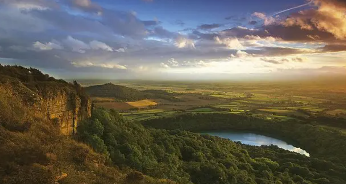
The escarpment the long loop follows before dropping into the woods to the lake.
The route in outline
The loop starts at the Sutton Bank National Park Centre, follows the escarpment along the line of the Cleveland Way, takes in the White Horse of Kilburn, and at some point drops off the edge into the woods to the lake before climbing back to the top. Roughly eight miles in all. I have not written it as a set of turns, because I have not yet walked it myself, and a wrong instruction here puts someone on a steep wooded descent below an unfenced cliff. Carry the OS sheet and follow the waymarking on the ground.
The lake
Lake Gormire lies in the woods at the foot of the cliffs, one of the very few natural lakes in the North York Moors. It formed at the end of the last ice age when a landslip dammed the meltwater, and it has no stream flowing in or out. That, along with the dark still water beneath Whitestone Cliff, has earned it a good stock of legends, from a supposedly bottomless bottom to a ghostly white mare and rider. It sits within the Garbutt Wood nature reserve.
How this differs from the short walk
The three-mile circuit stays along the top: the view, the Cleveland Way and the White Horse, and back to the centre. This one adds the descent to the lake and the climb out again, which is where the extra five miles and nearly all the effort go. If the weather is closing in or the light is going, take the short one.
Before you go
Parking is at the National Park Centre, pay and display, with a tearoom and toilets at the start. The cliff edge along the escarpment is unfenced in places. There is more on the centre, the gliders and the view in the Sutton Bank guide, and our moorland safety notes are worth a read before any longer day out here.
Lake Gormire walk FAQs
How long is the Lake Gormire walk?
The classic longer loop from Sutton Bank is roughly eight miles, linking the escarpment, the White Horse and the lake. The shorter three-mile circuit stays along the top and does not drop to the lake.
Why is Lake Gormire unusual?
It is one of the very few natural lakes in the North York Moors. It formed at the end of the last ice age when a landslip dammed the meltwater, and it has no stream flowing in or out.
Where is Lake Gormire?
In the woods at the foot of the Sutton Bank cliffs, beneath Whitestone Cliff, within the Garbutt Wood nature reserve.
Is the walk down to the lake steep?
Yes. It is a fine loop, but a steep one down from the top of the escarpment and back up again.
What are the legends about Lake Gormire?
Its dark, still water has attracted a good stock of them, from a supposedly bottomless bottom to a ghostly white mare and rider.