Walks
The Farndale daffodil walk
By Jon Cosson · Updated 17 October 2026 · Checked 6 October 2026
For a few weeks each spring the banks of the River Dove in Farndale turn yellow with wild daffodils, smaller, paler and altogether more delicate than garden varieties. The walk that follows them, from Low Mill to Church Houses, is one of the easiest and best-loved routes in the North York Moors.
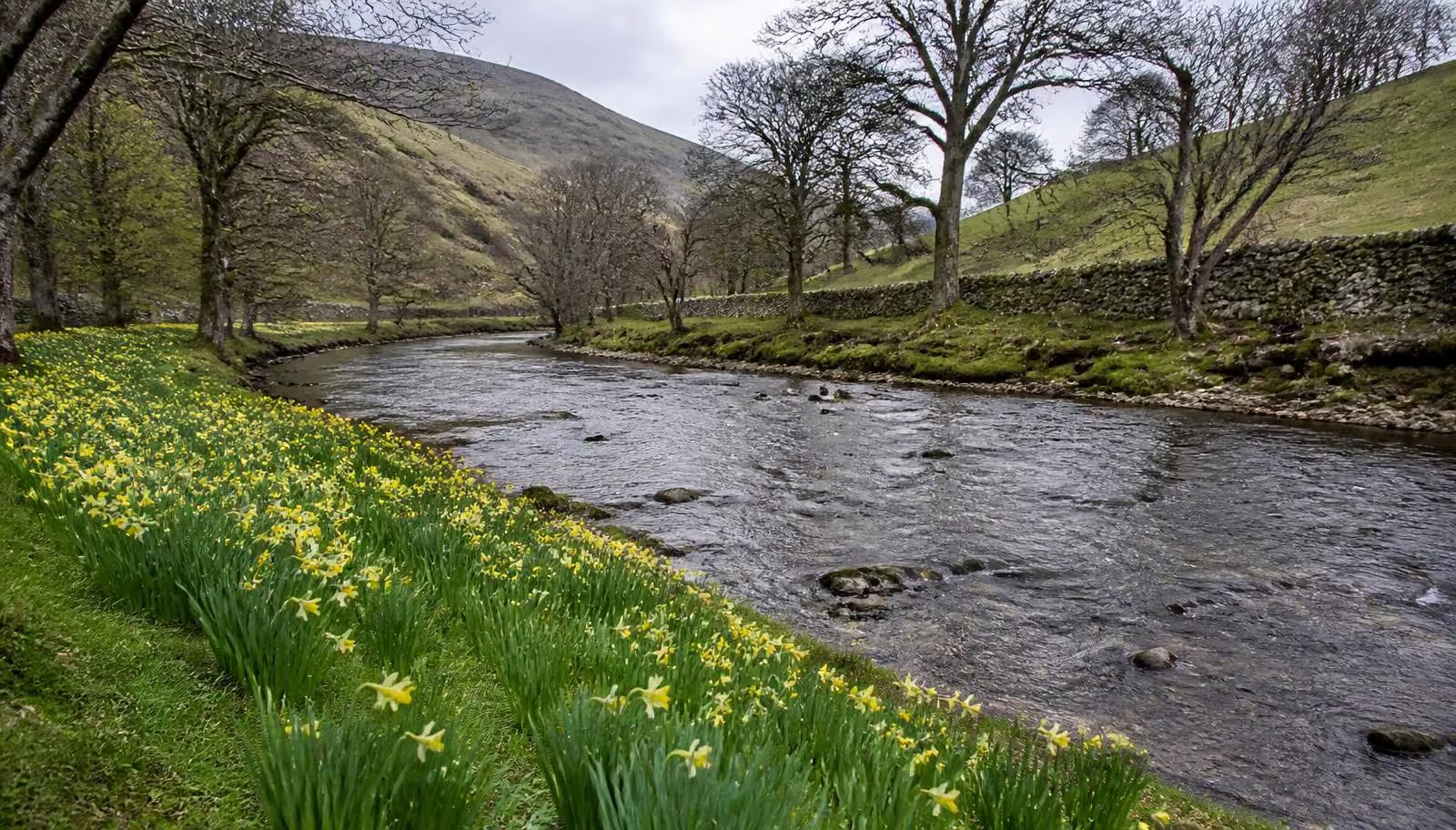
Wild daffodils along the River Dove in Farndale, the flowers are native and much smaller than garden daffodils.
The walk at a glance
- Distance
- 3.7 miles / 6.0 km, out-and-backThe National Park accessible there-and-back route, about 3 miles as the crow flies, not the optional field-path circuit
- Ascent
- 33 m ascent, 36 m descent, in the National Park route data
- Time
- 1.5 to 2 hours at a gentle pace, longer with photograph stops
- Difficulty
- Easy, no steps or stiles on the accessible route; some steep gradients and uneven or muddy surfaces
- Underfoot after rain
- The grass sections can be muddy
- Start & parking
- Low Mill National Park car park; Low Mill, Farndale (or Church Houses, walked in reverse); A current parking tariff was not confirmed; follow the signs at Low Mill; Both car parks are small; Fills early on fine spring weekends; nearest postcode YO62 7UY
- Waymarking
- Gates, no stiles on the accessible route; optional field paths are a different route
- Dogs
- Welcome on a lead. The route crosses working farmland with sheep and lambs in early spring.
- Pushchairs
- Suitable for most, with care. The National Park grades the daffodil path Miles Without Stiles, For some: a largely surfaced path with gates rather than stiles, a few short gradients and mud after rain
- Wheelchairs
- Graded Miles Without Stiles, For some, which the National Park defines as suitable for strong or assisted wheelchair users. The field-path return has occasional stiles and is not part of the accessible route
- Toilets
- In the car park, accessible with a RADAR key
- Public transport
- None. The National Park says there is no public transport to Farndale.
- Best season
- Peak is usually between mid-March and mid-April, and it moves each year
Opens the walk finder with this walk’s length and effort already set.
About this route
Route compiled from Ordnance Survey mapping and the published sources below. Parking, grid reference and transport details checked on 6 October 2026. If you walk it and find a change, use the contact page.
- October 2026: North York Moors National Park Authority Farndale daffodil walk, published on Outdooractive
- North York Moors National Park Authority
- Farndale village and parish information
- https://www.northyorkmoors.org.uk/places-to-go/farndale
- https://www.northyorkmoors.org.uk/plan-your-visit/car-parks-and-toilets/car-park-list
Distance notes: The National Park accessible there-and-back route, about 3 miles as the crow flies, not the optional field-path circuit.
Ascent: 33 m ascent, 36 m descent, in the National Park route data.
Area map
Low Mill, Farndale area. This map shows the area, not a verified route line.
When the daffodils peak
There is no fixed date. In an average year the flowers come out through the second half of March and hold into the first half of April, but a cold, late winter can push the display back by a fortnight and a mild one can bring it forward. Peak, when the banks are properly yellow rather than green with buds, usually lasts only a week or two.
Because of that, treat any date you read as a rough guide and check the current condition before you set off. The North York Moors National Park Authority and the Farndale village/parish channels post updates during the season, and the pub at Church Houses is a reliable source if you ring ahead. If you can be flexible by a weekend either way, you will see a far better display.
Parking and getting there
Farndale sits north of Kirkbymoorside, reached on narrow single-track lanes with passing places. The main daffodil-season car park is at Low Mill, near the start of the riverside path; there is a second small car park at Church Houses at the top end, beside the pub. A current tariff for these parking options was not confirmed; follow the signs on arrival.
Arrive before about 10am, or come late in the afternoon when the light is better anyway. Please do not park on the verges or in field gateways, this is a working dale and the lanes need to stay passable for farm traffic. No current seasonal shuttle was confirmed. The National Park says there is no public transport to Farndale.
The route
From Low Mill, drop down to the River Dove and follow the well-marked path upstream on the east bank. It runs close to the water for the whole way, through a series of kissing gates and over stone-flagged sections laid to protect the ground, with the daffodils spreading in drifts along the banks and out under the trees. There is no navigation to speak of, you simply follow the river.
After about a mile and a half the path reaches High Mill and the Daffy Caffy. Continue to Church Houses, where the pub makes an obvious turning point. Most people walk back the same way, which is no hardship as the view down-dale is the better of the two. If you want more, quiet lanes and field paths above the valley make a longer loop, though the flowers are firmly a riverside affair.
Doing it well
- Stay on the path. The daffodils grow in a local nature reserve; picking them or trampling the banks for a photograph is both unlawful and unkind to everyone behind you.
- Choose footwear with grip. Be prepared for wet flagged sections and muddy gate approaches; check recent conditions before setting out.
- Dogs on leads. Sheep and lambs are in the adjoining fields through the whole daffodil season.
- Go midweek if you can. Farndale is a small dale absorbing a lot of visitors in a short window.
Make a day of it
Farndale pairs naturally with Hutton-le-Hole, ten minutes away, where the Ryedale Folk Museum and the village green make an easy afternoon. The drive over Blakey Ridge to the Lion Inn is one of the finest moorland roads in the park, see our driving routes. For what else is worth timing a trip around, from lambing to the August heather, read the best time to visit.
Frequently asked questions
- When do the Farndale daffodils flower?
- Peak is usually somewhere between mid-March and mid-April, and it moves by a week or two each year depending on the winter. A cold spring pushes it later. Because the window is short, check a current report before you travel rather than booking on a fixed date.
- How long is the Farndale daffodil walk?
- The National Park accessible there-and-back route is 6 km, with 33 m ascent and 36 m descent. It has no stiles or steps, but includes some steep gradients and surfaces that can be muddy.
- Where do you park for Farndale?
- The main daffodil-season car park is at Low Mill, with a second option at Church Houses near the pub. Both are small and fill early on fine spring weekends; a current tariff was not confirmed and the single-track lanes in are not the place to park on verges.
- Can you pick the daffodils?
- No. The wild daffodils are protected within a local nature reserve, picking or digging them up is not allowed. Keep to the path, keep dogs on leads through the sheep fields, and let others get their photographs too.
- Are the Farndale daffodils dog friendly?
- Yes, on a lead. The route crosses working farmland with sheep and lambs in early spring, and there are gates but no stiles on the accessible route; optional field paths are separate.
Stay for daffodil season
Farndale is a short drive from Hutton-le-Hole and Kirkbymoorside, and about forty minutes from the cottages around Allerston and Thornton-le-Dale. Spring weekends book up early, the flowering window is narrow and locals know it.
Browse places to stay