Walks
Sutton Bank to the White Horse of Kilburn
By Jon Cosson · Updated 2 November 2026 · Checked
The upper escarpment path from Sutton Bank National Park Centre heads towards the White Horse of Kilburn. It is distinct from routes descending to Lake Gormire. Visit North Yorkshire lists this out-and-back as 1¾ miles (2.7 km), easy access, with a hard compacted surface and gradients no steeper than 1 in 12.
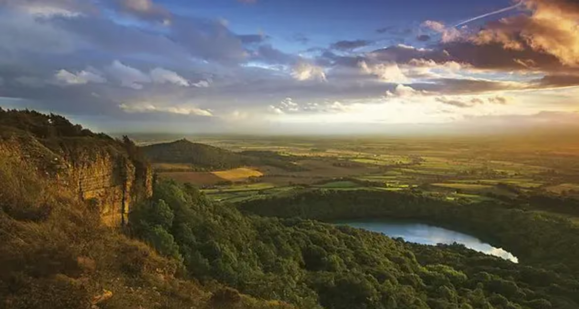
The view west from the Sutton Bank escarpment, which the walk follows for most of its length.
The walk at a glance
- Distance
- 1.75 miles / 2.8 km, out-and-backVisit North Yorkshire lists this length for the upper out-and-back route; it is not a three-mile circuit
- Ascent
- No total ascent published; the route listing gives gradients no steeper than 1 in 12
- Time
- About 1.5 hours, per Visit North Yorkshire
- Difficulty
- Easy, hard compacted surface; gentle gradients no steeper than 1 in 12, no gates or stiles
- Start & parking
- Sutton Bank National Park Centre car park; Sutton Bank National Park Centre, on the A170 between Thirsk and Helmsley; £3.90 up to 2 hours, £6.20 over 2 hours, coach £7.50; admission to the centre itself is free; grid ref SE 516 831 (National Park accessible viewpoints page); nearest postcode YO7 2EH
- Waymarking
- The Cleveland Way National Trail runs along the top of the bank
- Dogs
- Our Sutton Bank notes say only that the cliff edge is unfenced in places, so keep children and dogs close.
- Wheelchairs
- The circuit is not described as accessible. A short wheelchair-accessible path does run from the visitor centre to the main viewpoint, where a view indicator names the landmarks
- Toilets
- Accessible toilets and Changing Places at the National Park Centre
- Public transport
- Moorsbus, April to September at weekends and bank holidays. Nearest station Thirsk, 7.5 miles. Check times before you travel.
- Hazards
- The cliff edge is unfenced in places
- The White Horse
- Around 97 metres long, cut in 1857 by the local schoolmaster John Hodgson and his pupils, and maintained with chalk chippings over limestone
Opens the walk finder with this walk’s length and effort already set.
About this route
Route guidance from the published sources below, with mapping where available. Information last checked: 6 October 2026. Unconfirmed details and separately dated variants remain explicit. If you find a change, use the contact page.
- October 2026: https://visitnorthyorkshire.com/index/sutton-bank-white-horse-walk
- Visit North Yorkshire
- ThinkAdventure
- North York Moors National Park Authority
- https://northyorkmoors.org.uk/suttonbank
- https://www.northyorkmoors.org.uk/access-for-all/accessible-viewpoints
- https://www.northyorkmoors.org.uk/plan-your-visit/car-parks-and-toilets/car-park-list
Distance notes: Visit North Yorkshire lists this length for the upper out-and-back route; it is not a three-mile circuit.
Ascent: No total ascent published; the route listing gives gradients no steeper than 1 in 12.
Area map
Sutton Bank National Park Centre area. This map shows the area, not a verified route line.
The route in outline
The walk starts at the Sutton Bank National Park Centre at the top of the bank and follows the escarpment south along the line of the Cleveland Way, which runs right along the top here, out to the White Horse on Roulston Scar and back. The listing gives 1¾ miles (2.7 km) for the out-and-back, not each leg and not a three-mile circuit. Carry the OS sheet, follow the waymarking on the ground, and give yourself daylight on this exposed escarpment.
What you see along the way
The ground drops away almost immediately and the Vale of Mowbray and the Vale of York spread out below, with the Yorkshire Dales on the horizon on a clear day. It is the view James Herriot called the finest in England. The cliff edge is unfenced in places, so keep children and dogs close, and watch for the gliders of the Yorkshire Gliding Club riding the up-currents off the cliff face.
The White Horse itself
The horse is cut into the hillside on Roulston Scar, around 97 metres long, a hill figure on the escarpment. It was made in 1857 by the local schoolmaster John Hodgson and his pupils, and because the rock here is grey rather than the white chalk of the southern horses, it has to be maintained with chalk chippings. For views of the whole figure, consider viewpoints away from the hillside itself rather than the path immediately above it.
The shorter viewpoint option
A short wheelchair-accessible path runs from the visitor centre to the main viewpoint, where a view indicator names the landmarks and benches line the ridge. That alone gives you the view, without undertaking the longer escarpment path, and the centre has a tearoom, toilets, a shop and a natural play area for children. Admission is free and parking is pay and display.
A separate route towards Lake Gormire
A route descending into the woods towards Lake Gormire, one of the very few natural lakes in the North York Moors, and climbs back. It is a steeper and considerably longer day.
Sutton Bank to the White Horse: FAQs
How long is the walk to the White Horse of Kilburn?
Visit North Yorkshire lists the upper out-and-back route as 1¾ miles (2.7 km), starting and finishing at Sutton Bank National Park Centre. This is not the separate three-mile circuit descending around the horse.
Where do you park for the White Horse walk?
At the Sutton Bank National Park Centre on the A170 between Thirsk and Helmsley, postcode YO7 2EH. Parking is pay and display; admission to the centre itself is free.
How big is the White Horse of Kilburn?
Around 97 metres long. It was cut in 1857 by the local schoolmaster John Hodgson and his pupils, and because the rock here is grey rather than chalk it has to be maintained with chalk chippings white.
Is there an easier option than the full circuit?
Yes. A short wheelchair-accessible path runs from the visitor centre to the main viewpoint, where a view indicator names the landmarks, and benches line the ridge. That alone gives you the view the walk is famous for.
Is the cliff edge fenced?
No, the edge is unfenced in places, so keep children and dogs close.
Stay near the western moors
Helmsley, Rievaulx and the Hambleton Hills all put Sutton Bank within a short drive.
Browse places to stay