Walks
Hole of Horcum Walk
The Hole of Horcum is one of the North York Moors' most spectacular sights, a vast natural amphitheatre scooped from the moor beside the A169, and plenty of people drive straight past it on the way to Whitby without realising it's there. The classic circular walk runs along its rim, out across the heather of Levisham Moor and down through the bowl itself. Here's the route, where to park, and how to make the most of it.
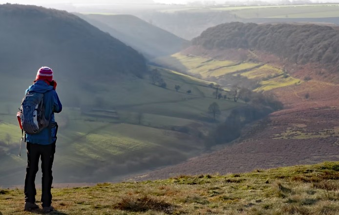
The Hole of Horcum natural amphitheatre seen from the Saltergate rim, North York Moors
The Hole itself, and the legend
The Hole is a vast natural amphitheatre, about 400 feet (120 m) deep and more than half a mile across. It's known locally as the "Devil's Punchbowl," and the best-loved legend says it was formed when Wade the Giant scooped up a handful of earth to hurl at his wife Bell during an argument, he missed, and the clod he flung landed a few miles away to form Blakey Topping, the lonely conical hill still there today.
The less dramatic truth is a process called spring-sapping: water welling up from the hillside has gradually undermined and eaten away the slopes over thousands of years, widening a once-narrow valley into the huge cauldron you see now, and the process still continues today.
There is now an accessible viewing platform at the rim by the car park, so the panorama is easy for everyone to reach even without doing the full walk.
The classic route (5 miles)
From Saltergate car park, cross the A169 with care and follow the path to the right around the rim, the panorama opens up almost straight away. Go through the gate onto Levisham Moor, where a wide track runs for roughly two miles across open heather moorland, the Hole falling away to your left and big skies all around. Levisham Moor is the largest ancient monument in the National Park: Bronze Age barrows and traces of far older occupation lie half-hidden in the heather, so keep to the path. At the signpost for the Hole of Horcum the route drops down through Dundale Griff and Horcum Slack into the bottom of the bowl, then returns along the valley and climbs back up to Saltergate. It's a walk that starts at the top, drops to the bottom, and finishes with a climb back out.
Route map and wayfinding
Start: Saltergate car park on the A169 (grid ref SE 853 937, nearest postcode YO18 7NR)
Start coordinates: 54.3208, -0.7043
- Saltergate car parkPark at the rim, take in the viewing platform, then cross the A169 with care.
- The rim path onto Levisham MoorFollow the path right around the rim and through the gate onto open moorland.
- Levisham Moor trackRoughly two miles of wide track across heather, the Hole falling away to your left.
- Dundale Griff and Horcum SlackAt the Hole of Horcum signpost, drop down into the bottom of the bowl.
- Climb back to SaltergateReturn along the valley floor and climb the final pull back to the car park.
A downloadable GPX track for this route is still to be added, for now, follow the wayfinding points above alongside OS Explorer OL27.
Wayfinding points are a guide only, check waymarking on the ground.
The Skelton Tower diversion (making it 7 miles)
For a longer day, a footpath leads west to Skelton Tower. A romantic ruin perched high above Newtondale, once a moorland retreat. It's one of the finest spots in the Moors to watch the steam trains of the North Yorkshire Moors Railway working up the valley below. The diversion adds roughly two miles, bringing the total to about 7 miles. On the longer loop you can also drop into the village of Levisham, where the Horseshoe Inn makes a good midway stop.
Parking, getting there and facilities
Saltergate car park sits right at the top of the Hole, beside the A169 Pickering–Whitby road. It's a North York Moors National Park pay-and-display car park, check the current charges and payment methods on the National Park website, as they change. It's a good size but fills on sunny weekends and through the heather season, so arrive early. There are no toilets at the car park or along the route; in summer there's often an ice-cream or coffee van. By bus, the scenic Coastliner (service 840) between York, Malton, Pickering and Whitby stops near Saltergate.
When to go
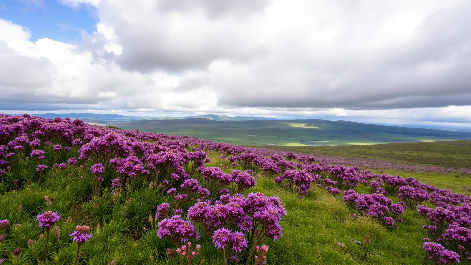
It's wonderful year-round, but the moor is at its finest in late August and September, when the heather turns the slopes purple. It's an exposed spot, so take layers even in summer, the wind finds you out on Levisham Moor. After rain the woodland and valley sections become muddy and slippery, so wear proper footwear. Our plan your visit guide covers the practicalities of a day out here.
Walking with dogs
Dogs are welcome but should be kept on a lead. The moor is grazed by sheep and sometimes highland cattle, and it's home to ground-nesting birds. Curlew, lapwing and golden plover among them, that nest on the open ground through spring and early summer, so a short lead genuinely matters, especially between 1 March and 31 July.
Make a day of it
The Hole of Horcum pairs naturally with the rest of this corner of the Moors: the village of Levisham and its station on the North Yorkshire Moors Railway, pretty Thornton-le-Dale a few miles south, and the forest trails and dark skies of Dalby Forest close by. For more walking nearby, try The Bridestones or Mallyan Spout.
Where to stay
Basing yourself close by turns this into an easy morning walk rather than a long drive, see where to stay in the North York Moors for the villages and types of accommodation that suit this side of the park.
Hole of Horcum walk FAQs
- How long is the Hole of Horcum walk?
- The classic circular is 5 miles (8 km) and takes about three hours. Adding the Skelton Tower diversion makes it around 7 miles (11 km) and about four hours.
- How hard is the Hole of Horcum walk?
- Moderate. There are a couple of steep sections in and out of the bowl, but nothing technical. It starts at the top, drops to the bottom and finishes with a climb back out.
- Where do you park for the Hole of Horcum?
- Saltergate car park on the A169 Pickering–Whitby road, right at the top of the Hole. It's a North York Moors National Park pay-and-display car park; grid ref SE 853 937, nearest postcode YO18 7NR.
- Can you take dogs on the Hole of Horcum walk?
- Yes, on a lead. The moor is grazed by sheep and sometimes highland cattle, and ground-nesting birds nest on the open ground through spring and early summer. A short lead matters especially between 1 March and 31 July.
- When is the heather out at the Hole of Horcum?
- The moor is at its finest in late August and September, when the heather turns the slopes purple.