Walks
Walks from Thornton-le-Dale
Thornton-le-Dale is a lovely place to start a walk, with a short, pretty stroll beside the beck in the village itself and a proper climb from the village edge up into Dalby Forest for longer Moors days. This page keeps to the highlights; the full set of village walks lives on the dedicated village guide, linked below.
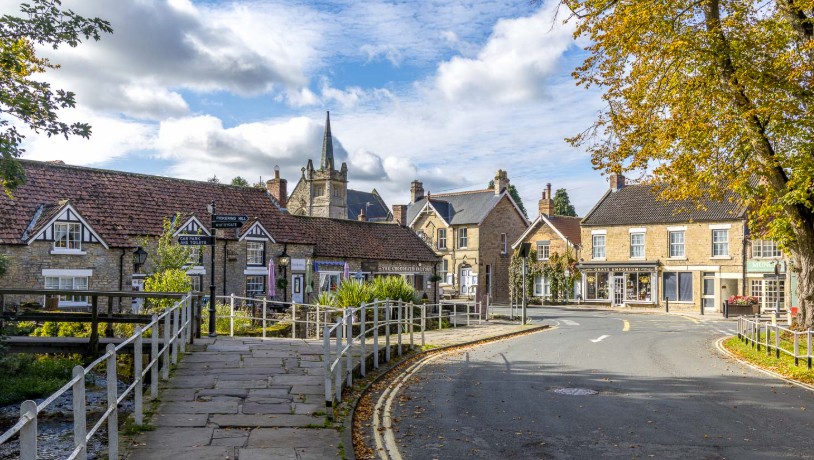
The heart of Thornton-le-Dale, where the beck runs beside the road and footpaths lead out into the dale and up onto the moor.
The full set of village walks
The dedicated Thornton-le-Dale village guide covers every walk from the door, including the woodland path to Ellerburn and its Saxon church, with route detail and parking. This page picks out the two walks that matter most in a wider Moors day.
The village stroll (about a mile)
The easy one is a loop of about a mile following Thornton Beck through the village and out along the field paths, passing the thatched Beck Isle Cottage and the green. Flat and sheltered, it suits an evening leg-stretch or anyone who would rather not climb. For the full route and the other walks from the village, including the woodland path to Ellerburn, see the village guide linked above.
Climbing into Dalby Forest (5 miles and up)
From the village edge, paths and lanes climb north into Dalby Forest, joining its huge network of waymarked woodland trails. Starting from the village means you skip the forest toll road entirely and can make the day as long as you like. See our Dalby Forest guide for the trail network, and the Bridestones walk if you want a proper moorland objective at the far end.
Route map and wayfinding
Start: Thornton-le-Dale village centre, by the beck and the green
Start coordinates: 54.2353, -0.7175
- Village centre and beckStart at the green, with the beck running beside the road and the thatched cottage nearby.
- Field paths out of the villageFollow the signed footpaths along the beck and out into open farmland.
- Climb towards DalbyContinue north on tracks and lanes to join the waymarked Dalby Forest trails.
- Return to the villageDrop back down the dale to the green, where the pubs and cafés are.
A downloadable GPX track for this route is still to be added, for now, follow the wayfinding points above alongside OS Explorer OL27.
Distances above are approximate; confirm against a local walk leaflet or OS Explorer OL27.
Parking and facilities
The village has a car park close to the green, plus shops, cafés, pubs and public toilets, which makes it one of the few walk starts in the Moors where lunch afterwards needs no driving. For charges, satnav details and motorhome bays, see parking and getting here on the village guide. Summer weekends fill early, so arrive in good time.
Walking with dogs
Dogs are very welcome here, and several village pubs have dog-friendly areas; see our dog-friendly pubs guide. Keep leads on through the village and across grazed fields, and read our walking with dogs notes before heading onto open moor.
Thornton-le-Dale walks FAQs
- Is there a good short walk from Thornton-le-Dale?
- Yes. A gentle loop of about a mile follows the beck through the village and out along the field paths, taking in the thatched cottage and the green. It is flat, easy and takes around half an hour.
- Can you walk from Thornton-le-Dale into Dalby Forest?
- Yes. Paths and lanes climb from the village edge into the forest's waymarked trail network, so you can build a longer Moors day without driving the forest toll road.
- Where can I find the full set of village walks?
- The dedicated village guide at thorntonledale.org covers the full set, including the woodland walk to Ellerburn and its Saxon church, with route detail and parking.
- Where do you park for walks from Thornton-le-Dale?
- There is a village car park a short walk from the green. For charges and satnav details, see the parking information on thorntonledale.org.