Villages & Places
Rosedale Abbey
By Jon Cosson · Updated 17 October 2026
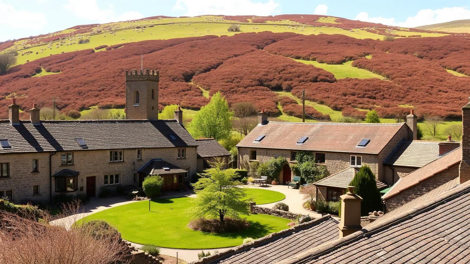
Rosedale Abbey sits deep in its own dale, a cluster of stone cottages around a green with the River Seven running past and heather moor climbing on every side. It has a vanished priory, one of the steepest roads in England, and a ring of Victorian ironstone ruins that make for some of the best level walking in the North York Moors.
Where it is, and getting there
Rosedale Abbey lies about ten miles north of Pickering, reached by narrow lanes through Wrelton and Cropton, or from the west over the moor from Hutton-le-Hole and Blakey Ridge. Whichever way you come, the last few miles are single-track in places with passing places and cattle grids, allow longer than the mileage suggests.
Public transport is minimal. The seasonal Moorsbus network reaches parts of the moors at weekends in the summer season; check the current timetable rather than assuming a service. For most visitors this is a car, motorcycle or cycling destination.
The abbey that isn't there
The village takes its name from a small Cistercian nunnery founded here in the 12th century, technically a priory, never an abbey. It was dissolved in the 1530s and then, over the following centuries, comprehensively robbed for building stone: much of the village you see today is made of it.
What survives is modest but genuinely worth five minutes. Beside the church of St Mary and St Lawrence stands a lone stone stair turret, the most substantial fragment left, along with a re-used pillar and an old sundial. There is no ticket office and no visitor centre, it is a corner of a churchyard. If you want ruins on a grander scale, the great Yorkshire abbeys at Rievaulx and Whitby are within an hour's drive.
Ironstone: the dale's second history
For a village this quiet, Rosedale had an extraordinary Victorian boom. From the 1850s ironstone was mined here in enormous quantity, the population multiplied several times over, and a railway was built round the rim of the dale to carry the ore out over the moor to Teesside. The industry collapsed in the 1920s and the dale emptied again.
The evidence is everywhere once you know to look: the massive calcining kilns at Rosedale East, spoil heaps softened by heather, and the trackbed of the old ironstone railway running level around the dale several hundred feet above the village. Some of the structures are fragile and fenced, read the interpretation boards and keep to the paths.
Walks from the village
The ironstone railway circuit. The classic Rosedale walk. The old trackbed is wide, well-drained and almost dead level, which makes it unusually easy walking for moorland at this height, with views down the whole dale. You can do a short out-and-back to the East kilns or commit to the full circuit of the dale head, which is a long day. Height is gained on the climb up out of the village, not on the trackbed itself.
Chimney Bank and Rosedale Moor. Walk or drive up the 1-in-3 bank to the moor top, where the stump of the old chimney once stood, for one of the best all-round panoramas in the park. It links onto the Blakey Ridge paths and the Lion Inn.
The River Seven. Gentle low-level paths along the river from the village give an easy hour with children or a dog, see our dog-friendly guide.
Check distances and conditions on a current OS map before you set out; moorland weather changes fast. More routes across the park are in our walks section, including the Farndale daffodil walk in the next dale west.
Eating and drinking
The guide records the Coach House Inn in the village and the White Horse Farm Inn above it. The Milburn Arms is closed. Confirm current arrangements with the trading pubs. More ideas in our food and drink guide, including where to find a proper Sunday lunch and pubs with a view.
- The Coach House Inn, Rosedale Abbey. Food Monday to Saturday 12 to 2 and 5.30 to 8; Sunday 12 to 8.
- White Horse Farm Inn, Rosedale Abbey. Food from noon on Friday, Saturday and Sunday but only from 5pm on other days. Breakfast is not included in the room rate and must be pre-booked. They run a motorhome stopover scheme. Check before travelling: the pub's own site had no recent dated information when checked in September 2026.
Parking and practicalities
A current official village-centre parking location and tariff could not be confirmed. Bank Top is a separate upland start for the railway-trackbed walk. Follow signs in the village and do not obstruct gateways or passing places.
Mobile signal in the dale is patchy: download maps before you arrive. There is no fuel in the village; fill up in Pickering or Kirkbymoorside. Take Chimney Bank seriously if you are towing, caravans and large motorhomes should approach Rosedale from the Pickering side instead.
Nearby, and making a day of it
Rosedale pairs naturally with Hutton-le-Hole and the Ryedale Folk Museum to the west, Blakey Ridge and the Lion Inn to the north-west, and Pickering, the steam railway and Dalby Forest to the south. The moorland roads in and out are also among the finest driving and riding in the park, see our classic-car driving routes and motorcycling guide. If you are planning a longer trip, start with our suggested itinerary.
Rosedale Abbey FAQs
- Is there actually an abbey at Rosedale Abbey?
- Not any more. The village is named after a small Cistercian nunnery, a priory rather than an abbey. Founded in the 12th century and dissolved in the 1530s. Almost all of it was quarried away for building stone; what survives is a single stone stair turret beside St Mary and St Lawrence church, plus a re-used pillar and sundial. It takes five minutes to see, and it is free.
- Where do you park in Rosedale Abbey?
- A current official village-centre parking location and tariff could not be confirmed. Bank Top is a separate start for the high-level railway walk, not a village-centre car park. Follow signs and keep passing places and gateways clear.
- How steep is Chimney Bank?
- Rosedale Chimney Bank, the road climbing south-west out of the village onto Rosedale Moor, is signed at 1-in-3 (33%) and is one of the steepest public roads in England. It is unsuitable for caravans and large motorhomes, and it can be closed by snow or ice in winter. In a car it is straightforward if you take it in low gear; on a bike it is a well-known test piece.
- What walks start from Rosedale Abbey?
- The best-known is the old ironstone railway trackbed that circles high round the dale, level, wide, and full of industrial remains including the Rosedale East kilns. Shorter options include the riverside path along the River Seven and a climb up Chimney Bank to the moor top. Check a current OS map or the National Park's route pages before setting off.
- Are there pubs in Rosedale Abbey?
- The guide records the Coach House Inn in Rosedale Abbey and the White Horse Farm Inn above the village. The Milburn Arms is closed and is not a visitor recommendation. Check the trading pubs directly for current arrangements.
- How far is Rosedale Abbey from Pickering?
- Roughly ten miles north of Pickering, about 25 minutes by car via Wrelton and Cropton. Hutton-le-Hole is a short drive west, and Blakey Ridge and the Lion Inn are up over the moor to the north-west.
Sources checked October 2026: National Park Rosedale guide; Coach House Inn.
Stay near Rosedale Abbey
Rosedale has a handful of inns and cottages and they book out early in summer. Many visitors base themselves on the quieter southern edge of the park and drive up over the tops.
Browse places to stay